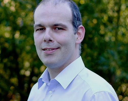
Luis Gomes, Head of Earth Observation at Surrey Satellite Technology Ltd (SSTL), shares with OLUSEGUN ORUAME, IT Edge News, the strategic importance of NigeriaSat-X and NigeriaSat-2
Is there a ground station in Abuja to monitor and control the data collected by Sat-X and Sat-2 and would SSTL consider as both untrue and unnecessary the controversy that has trailed this launch?
NASRDA has had a ground-station in Abuja since the launch of their first satellite, NigeriaSat-1, in 2003. The facility
has been upgraded in the last year, including the installation of a 7.3m metre antenna and it will be used by the Nigerian
engineers to track and operate NigeriaSat-1, NigeriaSat-X and NigeriaSat-2. Currently two joint NASRDA-SSTL teams are
working in parallel in Abuja and Guildford, UK to commission NigeriaSat-X and NigeriaSat-2. After this initial
commissioning phase is complete, the NASRDA team in the UK will return to Nigeria to continue NigeriaSat-X operations from
the Abuja ground-station. The decision to commission the spacecraft in parallel, using both SSTL’s ground-station in the
UK and NASRDA’s ground-station in Abuja, was made to make the process quicker and easier and this strategy has resulted in
the first image being downloaded from NigeriaSat-X only three days after launch.
What is the current state of the two satellites in space since they were officially launched and how long could the orbit
commissioning process take?
Following a successful launch into their planned orbit, both NigeriaSat-X and NigeriaSat-2 have proceeded on schedule with
commissioning, which will continue over the next two-three months, which is a normal period for satellite commissioning. We
are delighted with the progress of both satellites.
What exactly are the terms and objectives of the contractual agreement between Nigeria and the SSTL in respect of the SAT X concerning its features/capacity and expected deliverables to the NASRDA and the Nigerian people?
As a training satellite, NigeriaSat X’s major contribution to Nigeria has already happened: the training of a highly
capable group of Nigerians to undertake future space missions in an independent and self sufficient manner. That was the
main objective of the satellite. But since it has by design very interesting, capable and useful optical capabilities, the
satellite can also be used for resource management and mapping of the Nigerian territory. To list just some of its
capabilities, the satellite can:
Provide 22m multispectral image data for mapping, urban planning, agricultural monitoring, and disaster relief.
Provide data continuity and interface with NigeriaSat-1
Enhance national human resources to use space applications and to develop Nigerian capability in space
The satellite will be used by NASRDA alongside NigeriaSat-2 to provide a complementary service to it and will also
contribute imagery to the International Charter: Space and Major Disasters, through membership of the Disaster Monitoring
Constellation, continuing Nigeria’s important contribution to this United Nations endeavour. Any further clarifications
regarding uses of data can only be given by NASRDA as they are the satellite owners and operators.
Would you say SAT X embodies a Nigerian capacity to build satellites in orbit and signifies the start of appreciable
presence of skilled Nigerians in the very advanced terrain of satellite technology?
The new generation of Nigerian scientists and engineers trained under the NigeriaSat-X project will continue to support
Nigeria’s space programme, ensuring its continued success and sustainability. In total, 26 Nigerian engineers trained at
SSTL’s facilities in the UK over an eighteen month period throughout the design and test period and were responsible for
the build, test and commissioning of NigeriaSat-X. SSTL believes that the work that the success of the NigeriaSat-X
project is a great credit to NASRDA and their engineers. As well as providing direct capability for space engineering
these development programmes provide excellent generic enginering skills that can be used in the development of a
knowledge-based economy.
What is SSTL’s reaction to the media controversy in Nigeria as the partner to NASRDA on a project that hinges on its own
integrity as a satellite engineering company?
SSSTL is proud of our work with NASRDA, both on NigeriaSat- 1, which was a huge success over its seven years of operations
and now on NigeriaSat-2 and NigeriaSat-X – spacecraft which are also both working very well to date. We believe that the
programme of training at SSTL undertaken by the Nigerian engineers is inspirational and helps develop new technologies in
Nigeria, helping to underpin its educational and technological future. The data from both satellites will be used to
benefit the nation, providing improved monitoring of precision agriculture, land-use to plan improvements to the national
infrastructure, and disaster response.
SSTL also built SAT 1, from your own perspective, what would you say has been the benefit of that low orbit satellite to
Nigeria in terms of its applications and what benefits do the new satellites hold?
NigeriaSat-1, NigeriaSat-2 and NigeriaSat-X are complementary in providing different types of data. NigeriaSat-1 has
proven very effective in disaster response and land-use monitoring on a very large scale, using its wide swath and medium
resolution imager to see the big picture and NigeriaSat-X will provide continuity of this data. NigeriaSat-2 will provide
detailed imagery of particular areas not visible with the medium resolution imager. For instance, precision agriculture
has always been possible using imagery from NigeriaSat-1 but the smaller pixel size of NigeriaSat-2 imagery will enable an
increase in efficiency by looking at much smaller areas in greater detail allowing more accurate targeting of fertilizers.
NASRDA will be able to use the medium swath imagers on board NigeriaSat-X and NigeriaSat-2 to take big pictures which then
allow them to decide where to focus the high resolution imager on-board NigeriaSat-2 for maximum benefit.
Often, the argument has been whether Africa needs to delve into this terrain in the first place or should simply depend for
satellite based images on offshore satellite services providers, does any African country really need to invest in this
field in the face of other pressing and competing needs?
SSTL supports emerging space programmes in developing nations and we believe that by having their own satellites, countries
can provide their own information that they would normally have to buy at a high cost, whilst also benefiting from the
technological and educational aspects which a national space programme can provide – often sparking new technologies,
especially in the space sector.
COVER IMAGE: Luis Gomes, cortesy of SSTL


